Sub-Surface Utility Location

Our goal at TerraViz Geospatial is to provide Engineers, Architects, Contractors and private property owners with utility location and mapping services to help our clients to avoid unforeseen subsurface hazards when designing or excavating. We help professionals make the right design decisions throughout the project, in the office and in the field during construction.
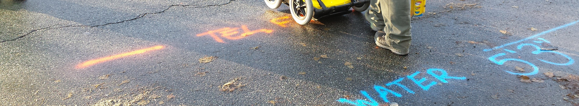
TerraViz Geospatial uses the most advanced electromagnetic line locating and ground penetrating radar equipment available to us from Vivax-Metrotech.

Our utility locating and mapping services follows CI/ASCE 38-02 Standard Guidelines for the Collection and Depiction of Existing Subsurface Utility Data.

TerraViz Geospatial also offers storm sewer pipe and structure location and inspection to assess the structural integrity with the use of a high definition, record capable, self-leveling Vivax-Metrotech camera, so that our reports have the capabilities to includes a photos and video products.

Related Solutions

  • Boundary Surveys

    Boundary surveys have been an integral part of the surveying industry for hundreds of years. Why and when you need a survey becomes obvious...

    Learn More

    Topographic Surveys

    Creating solutions for design and interpretation of the 3dimensional surface of the earth requires a topographic survey. TerraViz uses the latest generation in technological...

    Learn More

    Utility Route Surveys

    Route surveys are an essential step in the pre-construction process for pipelines, roadways, transmission lines and other utility routes. TerraViz Geospatial has years of...

    Learn More
  • As-Built Survey Mapping

    As-built surveys are a critical component of many markets. Our as-built deliverables are created for the professional in any format that meets the client...

    Learn More

    Sub-Surface Utility Locations

    Our goal at TerraViz Geospatial is to provide Engineers, Architects, Contractors and private property owners with utility location and mapping services to help our...

    Learn More

    UAV LIDAR Mapping

    We pride ourselves on providing safe, cost effective, and intelligent solutions for your surveying, mapping, modeling, and marketing needs. Our survey grade UAV platform...

    Learn More
  • Site Construction Layout

    TerraViz provides critical solutions to the construction industry. From site layout to foundation and steel erection, the first professional on a construction site is...

    Learn More

    Structural Scanning/3D Modeling

    High Definition 3D Laser Scanning – Laser scanning is ideal for 3D modeling of large-scale scenes, both indoor and outdoor. Facility Managers can now...

    Learn More